This site is supported by our readers. We may earn a commission, at no cost to you, if you purchase through links.
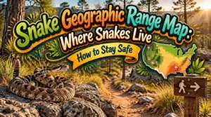
Georgia hosts about 47 native snake species. Michigan has 18. That gap isn’t random, and a snake geographic range map shows you why.
You’re looking at verified sightings and modeled habitat, shaded dark where conditions suit a species best and light where it rarely turns up. Prairie rattlesnakes climb to 2,775 meters in Wyoming. Eastern diamondbacks stay hidden in coastal longleaf pine and tortoise burrows. Your trail might cross either one, or neither.
Reading these maps tells you which snakes share your ground and which ones to watch for. Here’s how to read them, and how to use them.
Table Of Contents
- Key Takeaways
- What a Snake Geographic Range Map Shows
- Where Snakes Live: Global Distribution and U.S. Diversity
- Comparing U.S. Snake Range Maps by Species
- How Climate Change and Habitat Loss Shift Snake Ranges
- Using Snake Range Maps for Safer Wildlife Encounters
- Frequently Asked Questions (FAQs)
- Where are snakes located in the US?
- At what elevation are there no snakes?
- How far north can you find snakes?
- Which US state does not have snakes?
- How do I find out which snake species live in a state?
- Where do snakes live in North America?
- Where do rattlesnakes live in the winter?
- How do you identify a venomous snake in Virginia?
- How Can I Protect Rattlesnakes From Persecution?
- What Do Rattlesnakes Typically Eat?
- Conclusion
Key Takeaways
- Snake range maps use darker shading for the best habitat and lighter shading for places where a species rarely turns up, so you can see at a glance which snakes share your ground.
- Warmth and habitat variety drive how many species live where you are, which is why Georgia has about 47 native snakes while Michigan has just 18.
- Climate change and habitat loss are pushing snakes northward and uphill, and farms and cities can block their path, so forest specialists and cool-zone species like rattlesnakes face the biggest risks.
- Check which venomous species live along your route and season before you hike, remember that maps are coarse, so scout the trail itself, and wear gear that fits the risk.
What a Snake Geographic Range Map Shows
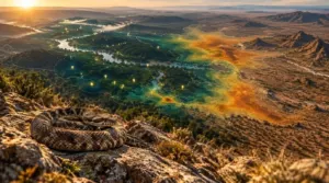
Where does a snake actually live? Snake geographic range maps show you exactly that. They mark the areas where a species is known to occur, based on verified occurrence records. Absence is harder to prove than presence, because detection probability rises with population size, and a study of three European snake species needed up to 34 surveys per site to infer absence with 95% probability. You’ll see color-coded zones for current and historic range boundaries.
Understanding local snake distribution through range maps starts with the color gradient. Dark zones mean best habitat. Light zones mean low probability of presence. That’s habitat suitability modeling at work. Most maps use species distribution models like MaxEnt, which turn temperature, precipitation, and elevation into a score from zero to one.
Rattlesnakes live only in the Americas, so comparing them with snake species native to Africa shows how range patterns shift across continents.
Some maps also show how climate change impacts distribution. You’ll spot range contractions and potential shifts too. Fun fact: your phone’s weather app uses similar color scales. Check dates.
Where Snakes Live: Global Distribution and U.S. Diversity
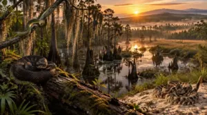
Snake geographic range maps reveal one clear pattern first: snakes love warmth. Species richness peaks near the equator and drops toward the poles. Tropical climates stay stable, so species have had millions of years to specialize.
The United States hosts about 150 snake species, and regional snake populations vary dramatically across the US. Look at the southeastern United States. Georgia alone has roughly 47 native species. South Carolina and Kansas each report 38. Wisconsin has 21, Delaware 19, and Michigan just 18.
To see how these numbers play out on the ground, this snake habitat map of the United States shows where species cluster across forests, wetlands, and grasslands.
Why the gap? Temperature, rainfall, and habitat mix drive it. Wetlands like the Okefenokee Swamp pack in cottonmouths and diamondbacks. Habitat diversity matters most for conservation efforts. Climate change is actively reshaping traditional snake ranges. Check your state.
Comparing U.S. Snake Range Maps by Species
Let’s compare U.S. snake range maps by species, starting with two pairs. First, you’ll see how range maps separate the Eastern Diamondback and Prairie Rattlesnakes. Then you’ll check where Corn Snakes and Gopher Snakes overlap on your map.
Eastern Diamondback and Prairie Rattlesnakes
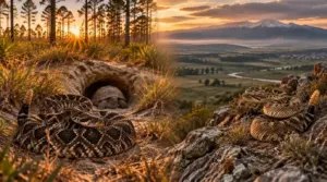
Prairie rattlesnakes reach 2,775 meters in Wyoming.
Though most snakes favor warm lowland habitats, prairie rattlesnakes thrive at high elevations too, and this guide to snake habitat and environment explains how different species adapt to such varied terrain.
Know the Eastern diamondback range: southeastern coastal plain. Prairie rattlesnake distribution spans Canada to Mexico. Desert environments in the Southwest support the most diverse rattlesnake populations.
- Diamondbacks: longleaf pine, tortoise burrows.
- Prairie rattlesnakes: grasslands, rocky areas.
- Threat: habitat fragmentation from urban encroachment.
Meanwhile, climate change reshapes where you’ll find snake species across America.
Corn Snakes and Gopher Snakes
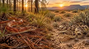
overlap in the central and southern U.S. Corn snakes range from New Jersey to Louisiana. Gopher snakes cover the West and Great Plains.
If you’re keeping corn snakes at home, recreating their warm, leaf-littered forest habitat is easier with this bioactive corn snake setup guide.
Habitat distribution differs. Corn snakes like pine forests; gopher snakes prefer prairies and deserts. Species distribution models and habitat suitability models sharpen maps. Edges stay fuzzy. Always carry a snake identification guide.
How Climate Change and Habitat Loss Shift Snake Ranges
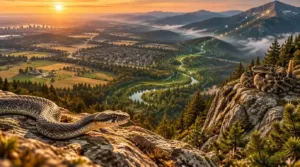
A warming planet is redrawing your snake range map. Climate change reshapes where you’ll find snake species across America, and the shifts are happening now. Temperature effects force populations northward and uphill. Climate modeling reveals dramatic snake migration routes, which is exciting for mastery and useful for safety.
But snakes can’t always follow the warmth. Habitat loss due to expansion of farms and cities blocks their path. Here’s what you should watch:
Snakes may chase the warmth, but farms and cities are closing the path
- Cool-zone species like rattlesnakes may lose range.
- Gray ratsnakes gain northern ground but lose farmland habitat.
- Generalists thrive near farms and suburbs.
- Forest specialists face the steepest declines.
- Habitat connectivity decides who actually reaches new areas.
Protect corridors and restore habitat near you, and you’ll help snakes adapt.
Using Snake Range Maps for Safer Wildlife Encounters
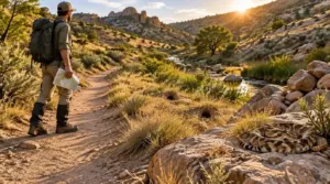
You can use snake range maps before you ever lace up your boots. Check which venomous species live along your route. Then match that to the season. Snake behavior patterns shift, so spring and fall mean dens, summer means foraging corridors.
Look at snake habitat distribution up close. Rock piles, creek edges, and rodent burrows raise your odds of a meeting. Maps are coarse, so scout the trail itself.
Pick gear that fits the risk. Snake gaiters make sense in viper country. Standard boots work where harmless colubrids dominate.
Snake encounter avoidance is simple. Watch your step, stay on open paths, and never reach blindly. Good wildlife safety outdoors starts with a map and a little curiosity. Enjoy the hike! Pack a compact snake bite kit for hiking with a pressure bandage and emergency info, and skip suction pumps, since they don’t work.
Frequently Asked Questions (FAQs)
Where are snakes located in the US?
You’ll find snakes almost everywhere in the US except Alaska. Hawaii has introduced species. Recent sightings, scientific surveys and reliable data sources, plus geographic information systems and species distribution models, show where snakes are located.
At what elevation are there no snakes?
Mountains work like a dimmer switch, not a wall. No universal elevation is snake-free. Thermal regulation limits them, yet Himalayan pit vipers reach 4,900 meters up. Check local species records before assuming you’re truly safe.
How far north can you find snakes?
You’ll find the northernmost snake habitats in Scandinavia, where the cold-tolerant European adder reaches about 70°N. Climate-driven range limits stop most snakes south of those latitude boundaries, though geographic range expansion keeps nudging them north.
Which US state does not have snakes?
Alaska. You won’t find established native snakes there, because its cold climate and long winters limit survival. Occasional pet snakes can turn up, but they’re not wild residents.
How do I find out which snake species live in a state?
Think of your state as a library, and snakes are its books. Start with your wildlife department’s website, then check occurrence records and species distribution maps. Habitat suitability models and protected areas lists help too.
Where do snakes live in North America?
Snake country is a patchwork quilt. Where do snakes live in North America? Eastern diamondbacks prefer coastal plains, prairie rattlesnakes dominate the Great Plains, timber rattlesnakes in Appalachian forests.
Habitat diversity essential for conservation efforts.
Where do rattlesnakes live in the winter?
Winter locks the door, and rattlesnakes hold the key. You’ll find them in rattlesnake dens below the frost line.
Altitudinal migration brings them to hibernacula, where thermal ecology and slowed brumation physiology keep them alive.
How do you identify a venomous snake in Virginia?
Virginia has three venomous snake species. How do you identify a venomous snake in Virginia? Spot hourglass bands or rattles. Nonvenomous snake species mimic them; photograph from afar. Snake bite prevention: safety precautions encountering snakes.
How Can I Protect Rattlesnakes From Persecution?
Think of a rattlesnake as a shy neighbor in armor. You’ll curb snake persecution with public education coexisting snakes, better public perception of snakes, harassment reports, and habitat care.
Snake coexistence strategies ease human-wildlife conflict.
What Do Rattlesnakes Typically Eat?
Fearsome snakes, yet you’ll find mice dominate. Here’s what rattlesnakes usually eat: rodents and rabbits, plus lizards and birds when prey availability allows.
Predator-prey relationships and venom evolution shaped this rattlesnake diet, so stay alert.
Conclusion
A range map is a weather forecast for serpents. It can’t promise what you’ll meet, but it tells you what’s likely.
Check your snake geographic range map before every hike. Learn which species share your ground, and note their habitat, from longleaf pine to high sagebrush.
Watch where you step. Most want nothing to do with you, so give them room. Know the map, respect the range, and you’ll leave with nothing but a story.